Log in
All resources
Create a design
217 Free Images of 1869 Maps
history
historical
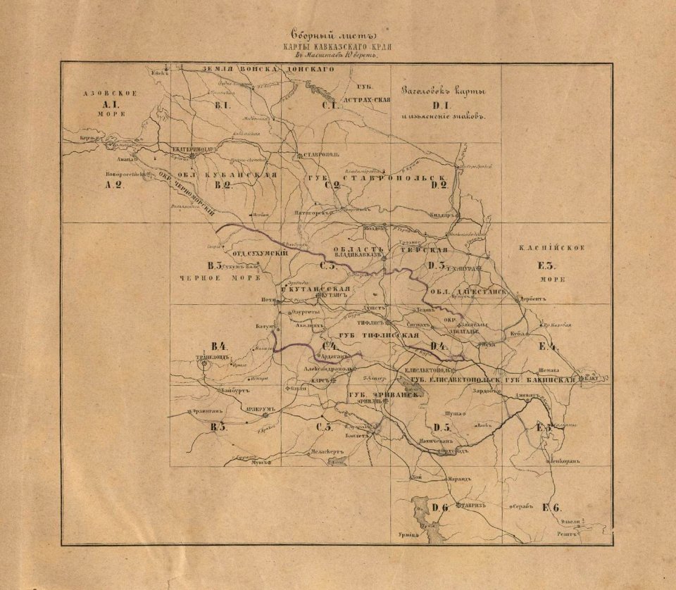
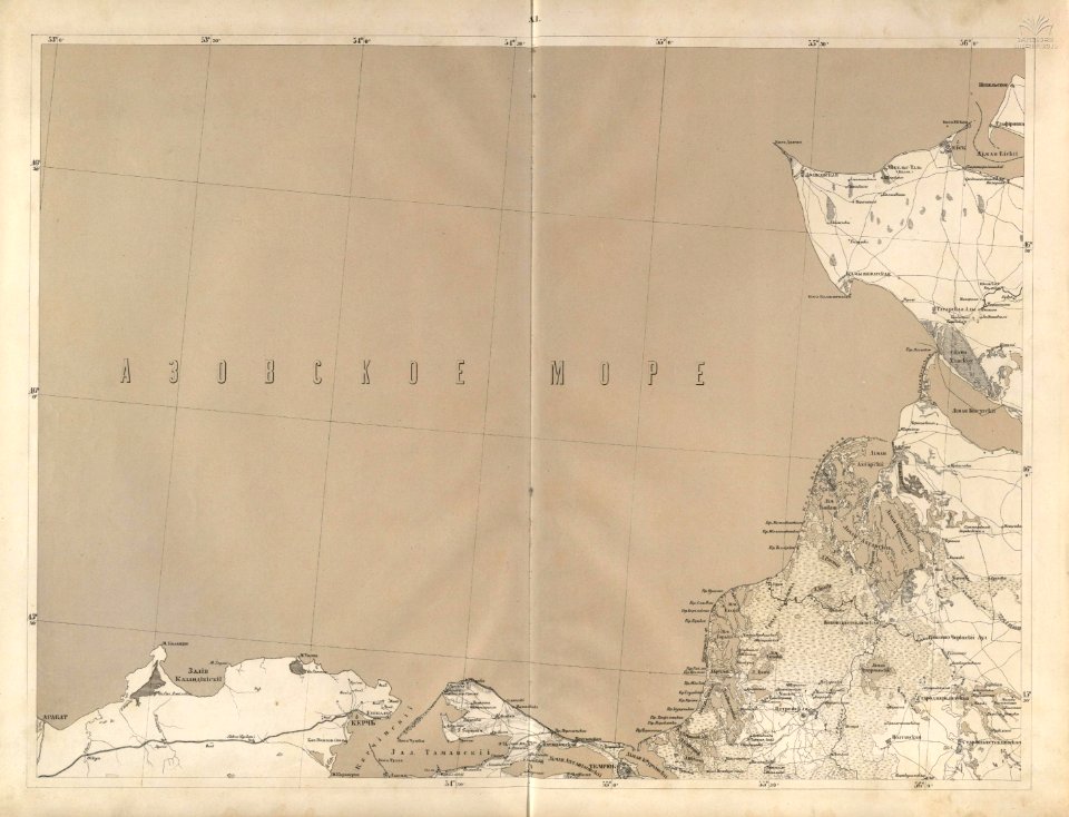
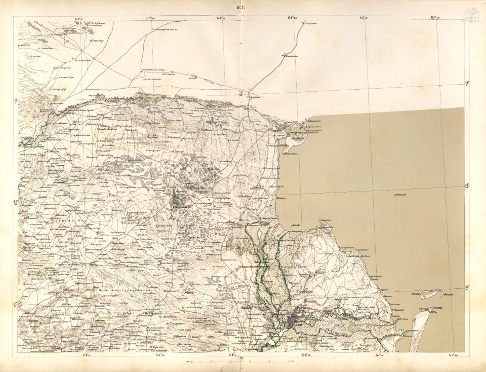
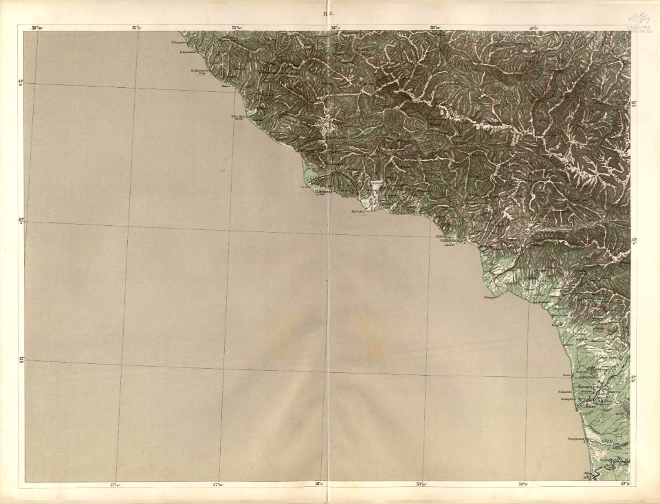
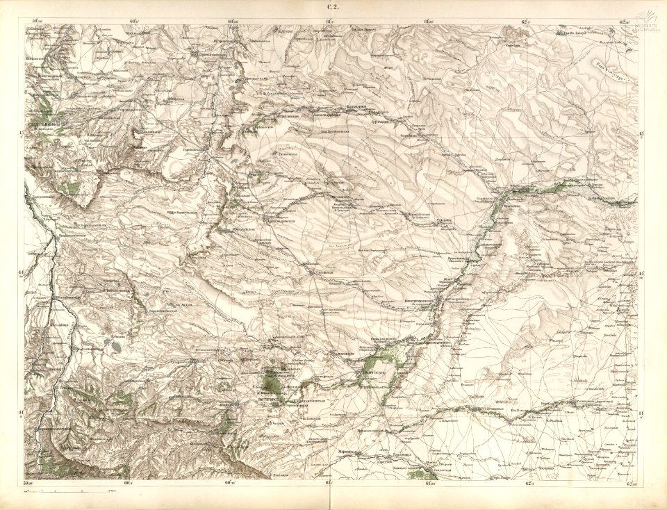
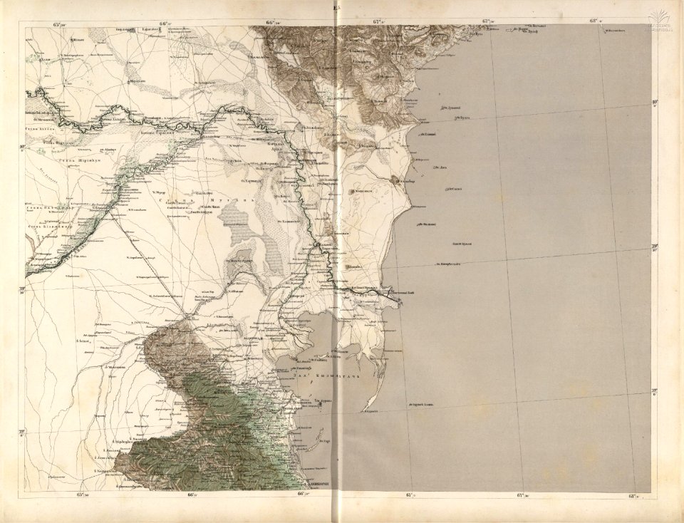
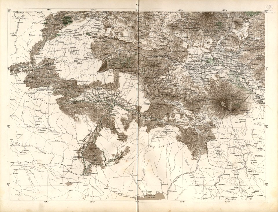
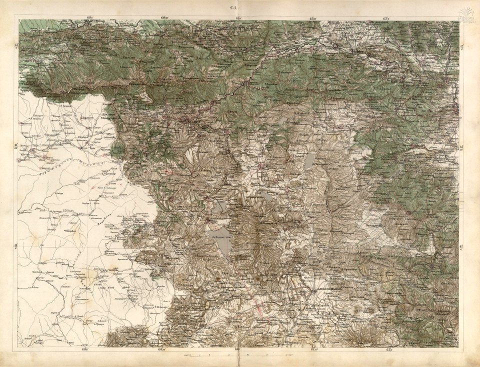
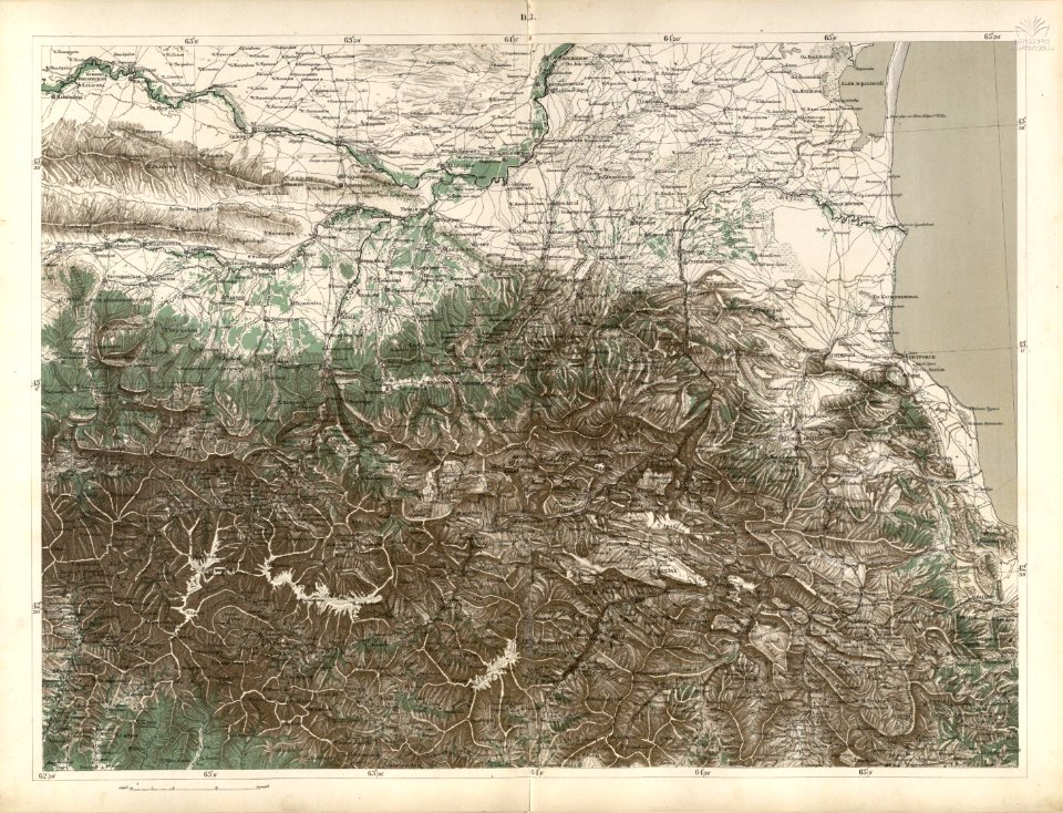
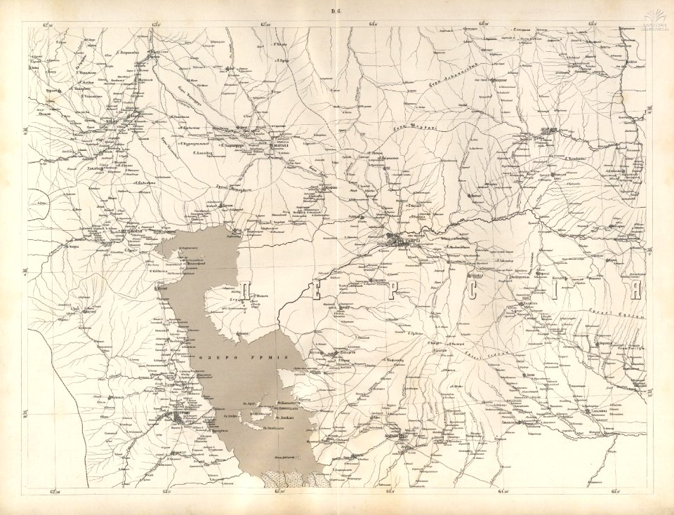
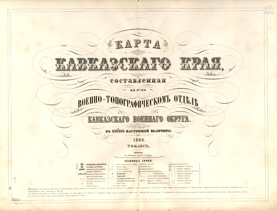
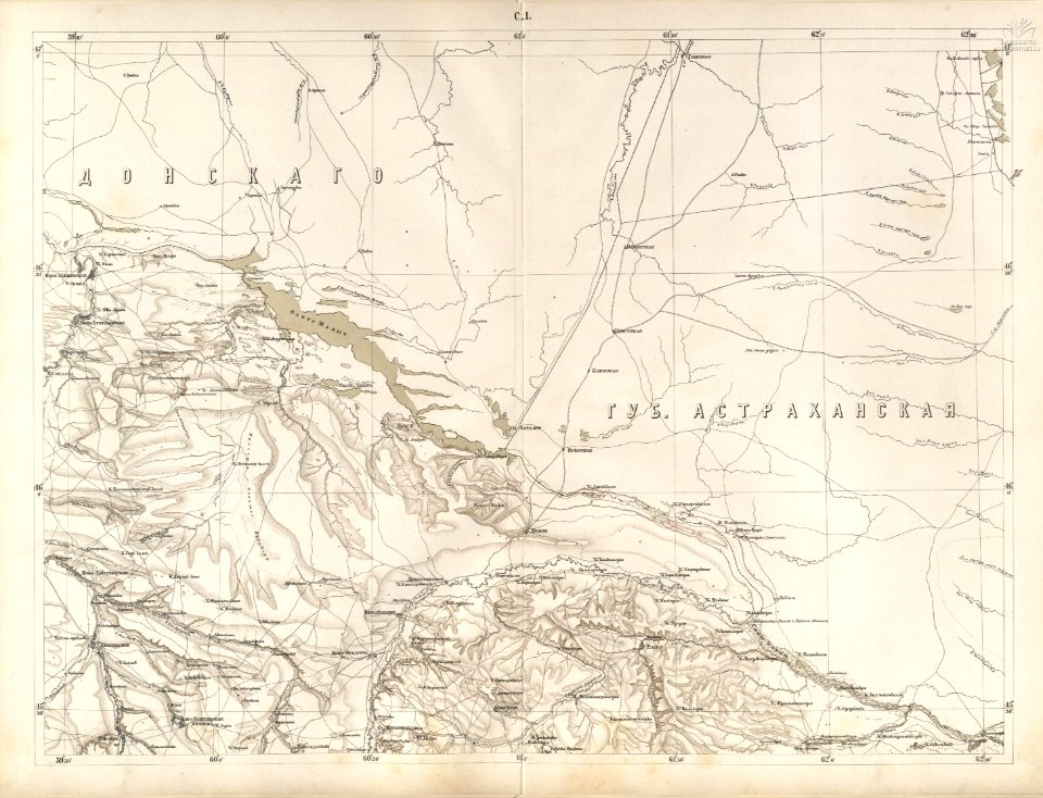
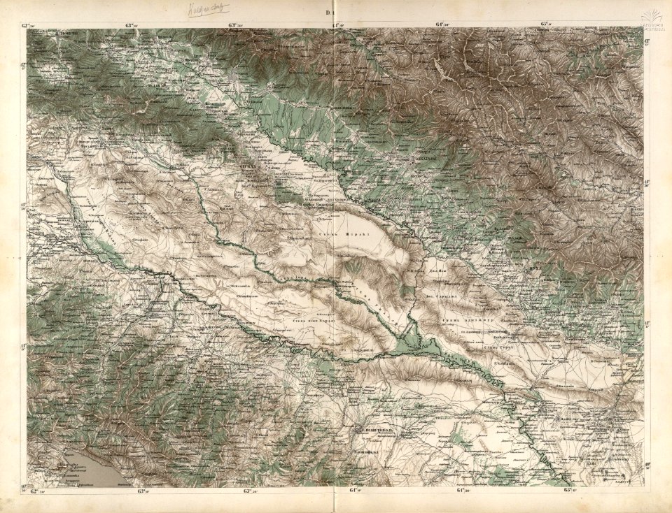
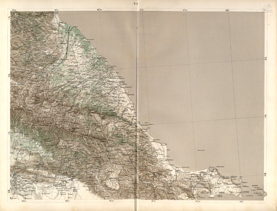
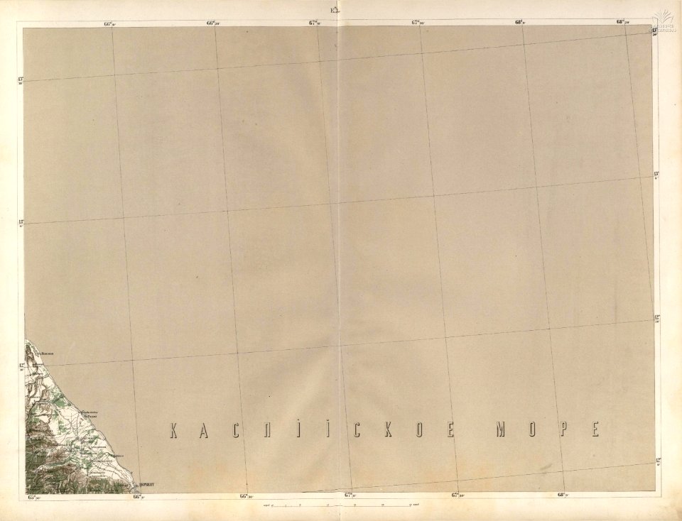
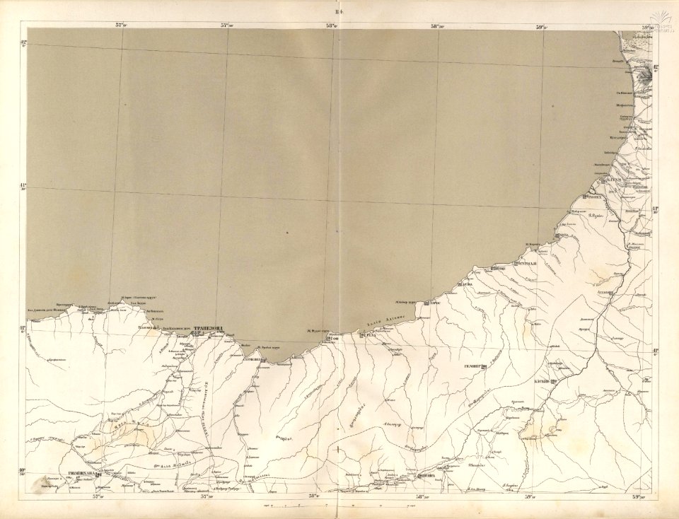
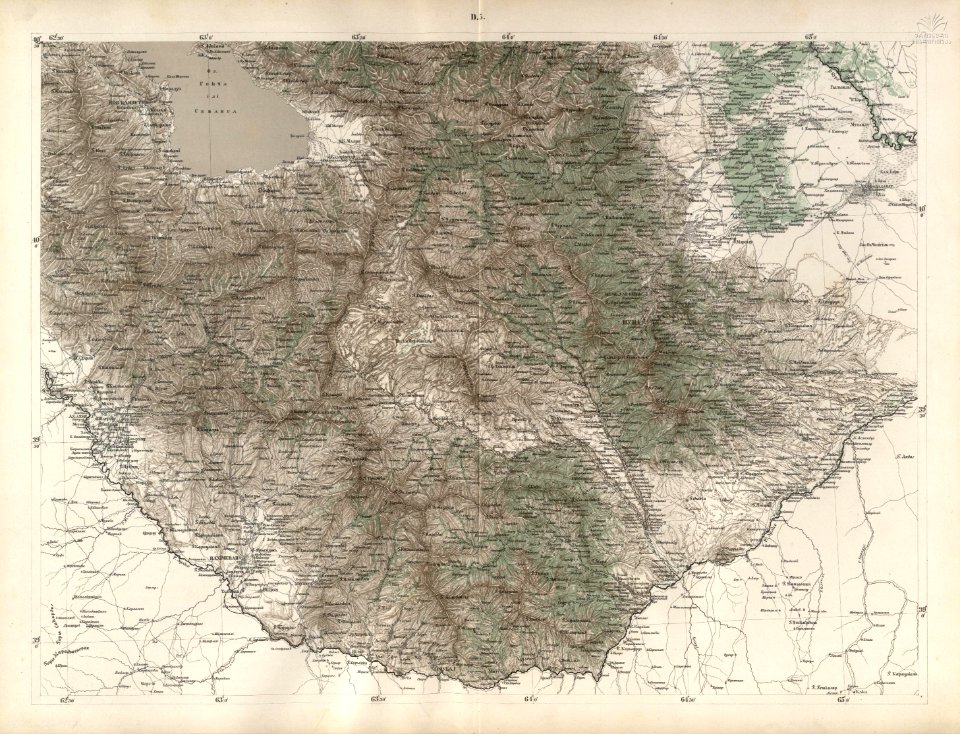
19th-century maps of the caucasus
gemeente atlas van nederland - north holland
1860s maps of north holland
orientalist painting
voyage à travers l'amérique du sud (1869)
gemeente atlas van nederland - south holland
old maps of the amazon river
pages with maps
architecture
roof
1860s maps of palestine
al-salihiyya
village
roof
self-published work
lawn
gemeente atlas van nederland - south holland
maps of alblasserdam
maps from the mechanical curator collection available to georeference
maps from the mechanical curator collection
1869 advertisements
1869 in boston
1869 advertisements
1869 in boston
self-published work
architecture
gemeente atlas van nederland - south holland
1860s maps of south holland
village
grass
self-published work
architecture
village
roof
maps of kodagu district
old maps of india
gemeente atlas van nederland - north holland
19th-century maps of den helder
st. helena - a physical, historical, and topographical description of the island (1875) by melliss
maps from the mechanical curator collection
maps from the mechanical curator collection available to georeference
maps from the mechanical curator collection
st. helena - a physical, historical, and topographical description of the island (1875) by melliss
maps from the mechanical curator collection
maps of kodagu district
edward weller
media from the national library of finland
classicism
gemeente atlas van nederland - south holland
maps of south holland
gemeente atlas van nederland - north holland
19th-century maps of amsterdam
gemeente atlas van nederland - south holland
maps of alblasserdam
gemeente atlas van nederland - north holland
maps of zwaag
gemeente atlas van nederland - north holland
maps of oudendijk
gemeente atlas van nederland - north holland
maps of krommenie
gemeente atlas van nederland - north holland
maps of wormer
gemeente atlas van nederland - north holland
maps of westzaan
gemeente atlas van nederland - north holland
maps of urk
a description of the new york central park (1869)
maps from the mechanical curator collection
gemeente atlas van nederland - south holland
old maps of gorinchem
gemeente atlas van nederland - north holland
old maps of hoorn, north holland
gemeente atlas van nederland - north holland
old maps of beverwijk
gemeente atlas van nederland - north brabant
maps of woudrichem
gemeente atlas van nederland - groningen
maps of bierum
gemeente atlas van nederland - north brabant
maps of nieuwkuijk
gemeente atlas van nederland - north brabant
maps of hilvarenbeek
gemeente atlas van nederland - south holland
maps of ameide
gemeente atlas van nederland - north brabant
maps of hoeven, north brabant
gemeente atlas van nederland - groningen
maps of winschoten
gemeente atlas van nederland - north holland
maps of beemster
gemeente atlas van nederland - north brabant
maps of gilze en rijen
gemeente atlas van nederland - south holland
old maps of brielle
gemeente atlas van nederland - groningen
maps of 't zandt
maps from the mechanical curator collection available to georeference
maps from the mechanical curator collection
gemeente atlas van nederland - south holland
1860s maps of south holland
old maps of the holy land
thomas fuller (writer)
le diable à paris-v4
gemeente atlas van nederland - south holland
maps of de lier
media from regionaal archief alkmaar
sint pancras
historical
history
media from regionaal archief alkmaar
sint pancras
historical
history
jesus of nazareth 1869
checkflicr2
historical
history
yokohama-e by utagawa yoshitora
ndl-dc 1312546 nishiki-e
admiralty charts region u: north america east coast
admiralty charts 201-400
historical
history
historical
history
historical
history
historical
history
historical
history
historical
history
historical
history
historical
history
historical
history
historical
history
historical
history
historical
history
historical
history
historical
history
historical
history
historical
history
historical
history
historical
history
historical
history
historical
history
maps of rivers of south america
orientalist painting
1869 maps of south america
orientalist painting
hokkaido kokugun zenzu
matsuura takeshirō
admiralty charts region t: west indies and central america
admiralty charts 401-600
yokohama-e by utagawa yoshitora
ndl-dc 1312546 nishiki-e
yokohama-e by utagawa yoshitora
ndl-dc 1312546 nishiki-e
yokohama-e by utagawa yoshitora
ndl-dc 1312546 nishiki-e
orientalist painting
1860s maps of peru
advertising posters of paris
6 rue victor-massé, paris
voyage à travers l'amérique du sud (1869)
orientalist painting
old maps of the amazon river
orientalist painting
old maps of the amazon river
orientalist painting
old maps of the amazon river
orientalist painting
old maps of the amazon river
orientalist painting
old maps of amazonas (brazil)
orientalist painting
old maps of the amazon river
orientalist painting
old maps of the amazon river
orientalist painting
old maps of the amazon river
orientalist painting
1860s maps of south america
orientalist painting
historical
history
advertising posters of paris
6 rue victor-massé, paris
manual of the corporation of the city of new york (1857)
1857 books
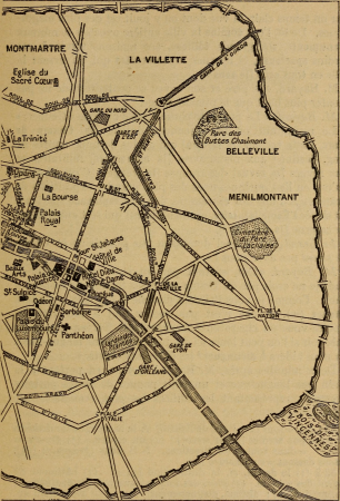
maps of paris in the 1910s
1910s maps of paris
101 - 200 of 217
Next page
/ 3